Image-based 3D Urban Tree Modeling
2013 | Dr. Justin Morgenroth, University of Canterbury
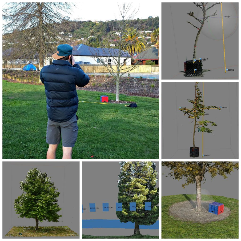
This research project aims to develop a simple new method for producing dimensionally-accurate 3D urban tree models using a basic digital camera. The technique we will assess (SfM: Structure-from-Motion) has successfully modeled the structure of objects less complex than trees (e.g. buildings). Our research group has previously produced accurate height and diameter estimates of trees in a pilot study using the SfM technique (published in Urban Forestry & Urban Greening). This research builds on the previous work by applying the technique across a range of tree forms, sizes and species to ensure its utility is widespread and not just a tool in the researcher’s toolbox.
Current approaches to tree mensuration typically include only linear measurements (e.g. height, DBH, crown spread). 3D attributes like above-ground volume (used in calculations in iTree), are estimated using allometric equations which can introduce significant error. Our 3D modelling approach will allow above-ground volume to be directly measured, not estimated. Implications exist for inventory, tree valuation, hazard tree assessment, benefit modelling, and arboriculture education.
Our method differs from previous image-based tree measurement efforts in that it’s the first to output a 3D tree model. Because it is not cost prohibitive, it is distinguished from LiDAR-based 3D tree modeling undertaken by others.
The John Z. Duling Grant provided research funding to test a 3D modelling approach for landscape trees. The technique, called Structure from Motion Multiview Stereophotogrammery (SfM-MVS) is fortunately much simpler than its name implies. A series of overlapping photographs is taken around a tree and then uploaded to a computer, where 3D modelling software aligns the images and reconstructs a geometrically correct 3D model of the tree. In theory, this 3D model will provide accurate measurements of the tree’s size (height, diameter, volume) and form. Masters student Jordan Miller, under the supervision of Dr. Justin Morgenroth and Dr. Christopher Gomez tested whether the SfM-MVS method did, in fact, produce accurate estimates of tree height, crown depth, average crown diameter, DBH, and above-ground volume. After a year of photographing, measuring, and destroying trees (to measure volume by water displacement), we conclude that the 3D models produced by SfM-MVS are of extremely high quality (< 10% error in most cases). With a small amount of training, this method will allow anybody to pick up a camera and, with a few clicks on a computer, get accurate estimates of standard tree inventory variables (e.g. height and dbh), but also tree volume. This is really interesting because volume is very challenging to directly measure and so it is typically estimated using simplified allometric formulae, which can be prone to high levels of error. SfM-MVS provides a very cheap alternative to more very expensive 3D modelling/measuring alternatives like LiDAR.
Year: 2013
Funding Duration: 1-3 years
Grant Program: John Z. Duling
Grant Title: Image-based 3D Urban Tree Modeling
Researcher: Justin Morgenroth
Key words: 3D modelling, forest inventory, laser scanning,LiDAR, PhotoScan, Terrestrial laser scanning
Peer Reviewed Publications from Grant:
- Miller, J., Morgenroth, J., Gomez, C. (2015) 3D modelling of individual trees using a handheld camera: Accuracy of height, diameter and volume estimates. Urban Forestry & Urban Greening 14(4): 932-940. View the Publication >
General Audience/Trade Publications:
Presentations:
- Morgenroth, Justin. 3D Tree Mapping: Rethinking the DBH Tape. August 12, 2015. International Society of Arboriculture Conference, Orlando, FL.

